


Heath Precinct 1, Franklin County, Massachusetts
About
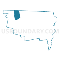
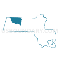
Outline

Summary
| Unique Area Identifier | 594149 |
| Name | Heath Precinct 1 |
| County | Franklin County |
| State | Massachusetts |
| Area (square miles) | 24.92 |
| Land Area (square miles) | 24.89 |
| Water Area (square miles) | 0.04 |
| % of Land Area | 99.84 |
| % of Water Area | 0.16 |
| Latitude of the Internal Point | 42.69327490 |
| Longtitude of the Internal Point | -72.82311260 |
Maps

Graphs
Select a template below for downloading or customizing gragh for Heath Precinct 1, Franklin County, Massachusetts


Neighbors
Neighoring Voting District (by Name) Neighboring Voting District on the Map
- Charlemont Precinct 1, Franklin County, MA
- Colrain Precinct 1, Franklin County, MA
- Halifax Voting District, Windham County, VT
- Rowe Precinct 1, Franklin County, MA
- Whitingham Voting District, Windham County, VT
Top 10 Neighboring County Subdivision (by Population) Neighboring County Subdivision on the Map
- Colrain town, Franklin County, MA (1,671)
- Whitingham town, Windham County, VT (1,357)
- Charlemont town, Franklin County, MA (1,266)
- Halifax town, Windham County, VT (728)
- Heath town, Franklin County, MA (706)
- Rowe town, Franklin County, MA (393)
Top 10 Neighboring Elementary School District (by Population) Neighboring Elementary School District on the Map
- Hawlemont School District, MA (1,603)
- Whitingham School District, VT (1,357)
- Halifax School District, VT (728)
- Rowe School District, MA (393)
Top 10 Neighboring Secondary School District (by Population) Neighboring Secondary School District on the Map
- Whitingham/Wilmington Joint Contract School District, VT (3,233)
- Mohawk Trail Regional School District in Hawley and Charlemont towns, MA (1,603)
- Mohawk Trail School District in Rowe (7-12), MA (393)
Top 10 Neighboring Unified School District (by Population) Neighboring Unified School District on the Map
Top 10 Neighboring State Legislative District Lower Chamber (by Population) Neighboring State Legislative District Lower Chamber on the Map
- Second Berkshire District, MA (40,125)
- First Berkshire District, MA (35,916)
- Windham-2 State House District, VT (3,961)
Top 10 Neighboring State Legislative District Upper Chamber (by Population) Neighboring State Legislative District Upper Chamber on the Map
- Hampshire & Franklin District, MA (156,938)
- Berkshire, Hampshire & Franklin District, MA (149,418)
- Windham State Senate District, VT (42,637)
Top 10 Neighboring 111th Congressional District (by Population) Neighboring 111th Congressional District on the Map
Top 10 Neighboring Census Tract (by Population) Neighboring Census Tract on the Map
- Census Tract 401, Franklin County, MA (4,494)
- Census Tract 9682, Windham County, VT (1,806)
- Census Tract 9681, Windham County, VT (1,357)
Top 10 Neighboring 5-Digit ZIP Code Tabulation Area (by Population) Neighboring 5-Digit ZIP Code Tabulation Area on the Map
- 01370, MA (4,084)
- 01340, MA (1,701)
- 01339, MA (1,438)
- 05361, VT (947)
- 05342, VT (581)
- 01346, MA (533)
- 01367, MA (522)